Ouseburn & Byker History: The Victoria Tunnel and the Byker Wall
How the Ouseburn valley became the cradle of Newcastle's industry, the coal tunnel that runs beneath it, and the celebrated Byker Wall that overlooks it.
East Newcastle wears its history close to the surface. Walk down from the Tyneside flats of Heaton into the Ouseburn valley and you cross the ground where the city's industry was born, pass over a coal tunnel that once sheltered thousands from the Blitz, and look up at one of Britain's most celebrated pieces of post-war architecture. This is a guide to the heritage of the Ouseburn and Byker, the mills, the tunnel, and the Wall.
The industrial cradle of Tyneside
Long before the Ouseburn became Newcastle's cultural quarter, it was its workshop. The Lower Ouseburn, the narrow valley where the burn meets the Tyne, was the cradle of the city's industry. From the 17th century onwards it filled with the trades that needed water, fuel, and a river to ship goods out: potteries and flint mills, glassworks, lead works, iron foundries, and flour mills, all crowded together beneath a tangle of road, rail, and river bridges.
Those industries left their mark on the landscape and the language of the place. Street and building names, Lime Street, Foundry Lane, the old maltings and warehouses now home to galleries and music venues, still record what the valley once made. The Victorian brick warehouses that give the Ouseburn its character today were built to serve that industrial economy; the same buildings now house Seven Stories, The Biscuit Factory, and a cluster of independent bars and studios.
The Victoria Tunnel
Best for:
The Victoria Tunnel is a preserved 19th-century waggonway beneath Newcastle. Guided tours run from the Lime Street meeting point in the Ouseburn and must be booked ahead, see Victoria Tunnel.
The valley's most remarkable survival runs underground. The Victoria Tunnel was cut between 1839 and 1842 as a subterranean waggonway, carrying coal from Leazes Main Colliery near the Town Moor down to riverside staithes on the Tyne, ready for loading onto ships. Loaded waggons ran down the incline under their own weight and were rope-hauled back up by a stationary steam engine. In full, the tunnel runs around 2.4 miles from the moor to the river, dropping some 200 feet along the way.
The colliery closed in 1860 and the tunnel was largely abandoned, until the Second World War gave it a second life. As bombing threatened Tyneside, the city converted the tunnel into a communal air-raid shelter. Blast walls were added at the entrances, a concrete floor was laid, electric lighting was fitted, and hundreds of bunks and benches were installed so that families could shelter underground through the raids.
Today a level section of roughly 700 metres is open to the public in the Ouseburn valley, cared for by the Ouseburn Trust. Volunteer-led tours take you into the cool, echoing dark to walk in the footsteps of the miners, waggon-men, and wartime families who used it, past recreated shelter sections with bunks and benches, and often accompanied by the memories of local people who sheltered here as children.
The Byker Wall
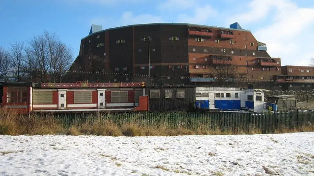
Rising above the valley to the east is a very different kind of landmark. The Byker Wall is a long, unbroken block of 620 maisonettes, the signature element of the wider Byker Estate. Designed by the architect Ralph Erskine with Vernon Gracie, it was built between 1969 and 1982 to replace the condemned Victorian terraces that had crowded the slopes of Byker.
The Wall's most striking feature is also the reason for its shape. Erskine designed the high, undulating outer block to shield the lower-rise homes behind it from wind, noise, and pollution, chiefly from a motorway that was planned to run alongside it, but which was never built. Behind the sheltering Wall, the estate opens out into a warmer, more intimate world of low houses, gardens, courtyards, and winding paths, softened with timber and colourful brickwork.
What sets Byker apart is not only its design but the way it was made. Erskine's team opened an office on site to work with the existing residents, keeping the community together where possible and drawing on their views, a pioneering piece of public participation for its time. When Historic England awarded the estate a Grade II* listing in 2007, it praised both the groundbreaking, Europe-wide influence of the design and this model of resident involvement. Byker remains one of Britain's most admired post-war housing schemes.
How to explore this heritage
The best way to understand east Newcastle is to walk it. Start high in Heaton and follow the green corridor down through the parks into the Ouseburn valley, where the industrial past is written into the warehouses and bridges around you. Book a place on a Victoria Tunnel tour to go beneath the surface, and take time to look up at the Byker Wall, best appreciated from the cycle path and open ground on its southern side, where the scale of Erskine's design comes into focus.
For the full sweep of the area's story, from the medieval manor above the Ouseburn to the industrial valley and the modern cultural quarter. See our history timeline of Heaton, Ouseburn, and Byker.
Local businesses mentioned
Never miss what’s on
Join the weekly Heaton.live digest — the best events, news and local tips, straight to your inbox. Free, one email a week.
What's On
Comedy Course Showcase: New Student Showcase 2
7:30 PM · The Cumberland Arms, James Place Street, Ouseburn, Newcastle upon Tyne, NE6 1LD
La Chimera
7:30 PM · Star and Shadow Cinema, Warwick Street, Newcastle upon Tyne, NE2 1BB
Fresh Thursday: Deradoorian + Silver Ley + Mason Lindahl
7:00 PM · Cobalt Studios, 10-16 Boyd Street, Ouseburn, Newcastle upon Tyne, NE2 1AP